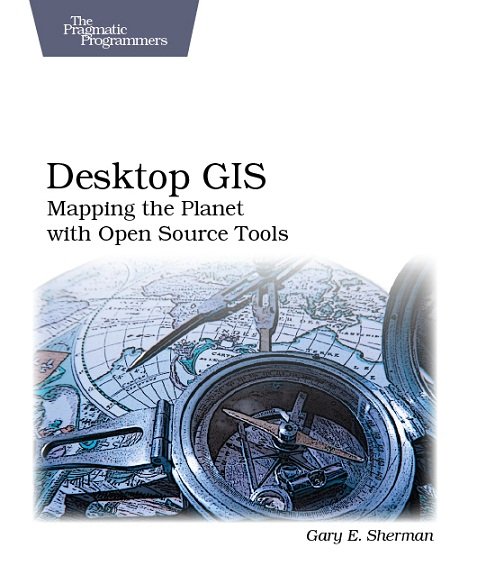
電驢下載基地 >> 图书资源 >> 計算機與網絡 >> 《桌面GIS應用系統》(Desktop GIS: Mapping the Planet with Open Source Tools)英文文字版/更新源代碼[PDF]
| 《桌面GIS應用系統》(Desktop GIS: Mapping the Planet with Open Source Tools)英文文字版/更新源代碼[PDF] | |
|---|---|
| 下載分級 | 图书资源 |
| 資源類別 | 計算機與網絡 |
| 發布時間 | 2017/7/10 |
| 大 小 | - |
《桌面GIS應用系統》(Desktop GIS: Mapping the Planet with Open Source Tools)英文文字版/更新源代碼[PDF] 簡介: 中文名 : 桌面GIS應用系統 原名 : Desktop GIS: Mapping the Planet with Open Source Tools 作者 : Gary E. Sherman 圖書分類 : 軟件 資源格式 : PDF 版本 : 英文文字版/更新源代碼 出版社 : Pragmatic Bookshelf 書號 : 978-1-93435-606-7 發行時間
電驢資源下載/磁力鏈接資源下載:
- 下載位址: [www.ed2k.online][桌面GIS應用系統].(Desktop.GIS).Gary.E.Sherman.文字版.pdf
- 下載位址: [www.ed2k.online][桌面GIS應用系統].源代碼.zip
全選
"《桌面GIS應用系統》(Desktop GIS: Mapping the Planet with Open Source Tools)英文文字版/更新源代碼[PDF]"介紹
中文名: 桌面GIS應用系統
原名: Desktop GIS: Mapping the Planet with Open Source Tools
作者: Gary E. Sherman
圖書分類: 軟件
資源格式: PDF
版本: 英文文字版/更新源代碼
出版社: Pragmatic Bookshelf
書號: 978-1-93435-606-7
發行時間: 2008年10月15日
地區: 美國
語言: 英文
簡介:

內容介紹:
Desktop GIS explores the world of Open Source GIS software and provides a guide to navigate the many options available. Discover what kind of GIS user you are and lay the foundation to evaluate the options and decide what software is best for you.
Desktop GIS examines the challenges associated with assembling and using an OSGIS toolkit. You’ll find strategies for choosing a platform, selecting the right tools, integration, managing change, and getting support. The survey of OSGIS desktop applications provides you with a quick introduction to the many packages available. You’ll see examples of both GUI (Graphical User Interface) and command line interfaces to give you a feel for what is available.
This book will give you an understanding of the Open Source GIS landscape, along with a detailed look at the major desktop applications, including GRASS, Quantum GIS, uDig, spatial databases, GMT, and other command line tools. Finally, the book exposes you to scripting in the OSGIS world, using Python, shell, and other languages to visualize, digitize, and analyze your data.
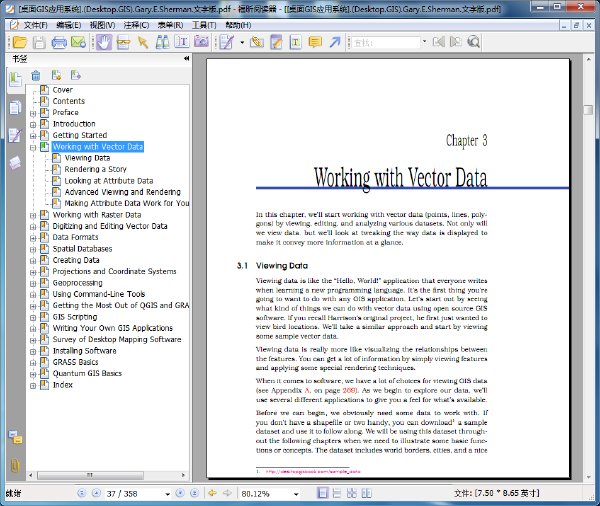
內容截圖:

目錄:
Preface
Introduction
Getting Started
Working with Vector Data
Working with Raster Data
Digitizing and Editing Vector Data
Data Formats
Spatial Databases
Creating Data
Projections and Coordinate Systems
Geoprocessing
Using Command-Line Tools
Getting the Most Out of QGIS and GRASS Integration
GIS Scripting
Writing Your Own GIS Applications
Survey of Desktop Mapping Software
Installing Software
GRASS Basics
Quantum GIS Basics
原名: Desktop GIS: Mapping the Planet with Open Source Tools
作者: Gary E. Sherman
圖書分類: 軟件
資源格式: PDF
版本: 英文文字版/更新源代碼
出版社: Pragmatic Bookshelf
書號: 978-1-93435-606-7
發行時間: 2008年10月15日
地區: 美國
語言: 英文
簡介:

內容介紹:
Desktop GIS explores the world of Open Source GIS software and provides a guide to navigate the many options available. Discover what kind of GIS user you are and lay the foundation to evaluate the options and decide what software is best for you.
Desktop GIS examines the challenges associated with assembling and using an OSGIS toolkit. You’ll find strategies for choosing a platform, selecting the right tools, integration, managing change, and getting support. The survey of OSGIS desktop applications provides you with a quick introduction to the many packages available. You’ll see examples of both GUI (Graphical User Interface) and command line interfaces to give you a feel for what is available.
This book will give you an understanding of the Open Source GIS landscape, along with a detailed look at the major desktop applications, including GRASS, Quantum GIS, uDig, spatial databases, GMT, and other command line tools. Finally, the book exposes you to scripting in the OSGIS world, using Python, shell, and other languages to visualize, digitize, and analyze your data.
內容截圖:

目錄:
Preface
Introduction
Getting Started
Working with Vector Data
Working with Raster Data
Digitizing and Editing Vector Data
Data Formats
Spatial Databases
Creating Data
Projections and Coordinate Systems
Geoprocessing
Using Command-Line Tools
Getting the Most Out of QGIS and GRASS Integration
GIS Scripting
Writing Your Own GIS Applications
Survey of Desktop Mapping Software
Installing Software
GRASS Basics
Quantum GIS Basics
- 上一頁:《GIS for Web 應用開發之道》(GIS for Web Developers: Adding Where to Your Web Applications)英文文字版/更新源代碼[PDF]
- 下一頁:《21天自學Java6 (第5版)》(Sams Teach Yourself Java 6 in 21 Days, 5th Edition)英文文字版/更新源代碼[PDF]
相關資源:
- [其他圖書]《單招制敵防衛術》掃描版[PDF]
- [文學圖書]《多彩的旋律-中國女性文學主題研究》掃描版[PDF]
- [其他圖書]《古譜秘籍少林內外輕功秘訣全本》掃描版[PDF
- [人文社科]《清十大名人家書》(襟霞閣)掃描版[PDF]
- [人文社科]<V9制作>《學校怪談》01-20(全)
- [其他圖書]《陳式太極拳精選》掃描版[PDF]
- [人文社科]《電影是什麼》((法)安德烈·巴贊)掃描版[PDF]
- [文學圖書]《三聲有幸》清晰掃描版[PDF]
- [生活圖書]《運動生理學健康,健身和性能-三版指南》(Exercise Physiology for Health, Fitness, and Performance,III[TPB])影印版[PDF]
- [計算機與網絡]《WordPress 寶典》(WordPress Bible)(Aaron Brazell)[PDF]
- [硬盤游戲]《奇怪策略:邪惡英雄》(Grotesque Tactics: Evil Heroes)綠色免安裝硬盤版[壓縮包]
- [人文社科]《所有女孩都應知道的》(Alles, was Mädchen wissen wollen)((德)特魯德·奧斯費德)中譯本,掃描版[PDF]
- [計算機與網絡]《Microsoft SQL Server企業級平台管理實踐》高清文字版[PDF]
- [生活百科]《FBI檔案中的神秘事件》掃描版[PDF] 資料下載
- [電腦基礎]《ASP.NET 基礎訓練》(Lynda.com ASP NET Essential Training)[光盤鏡像]
- [人文社科]《經典影片—青春之歌》(Song of youth)1CD[DVDRip]
- [行業軟件]《高終流程規劃設計》(Corel iGrafx Enterprise 2011)更新企業版v14.0.3.1260/多國語言含中文/含注冊機[壓縮包]
- [硬盤游戲]《銀河系大戰》(Aces of the Galaxy)完整硬盤版[壓縮包]
- [系統工具]WebQQ批量掛機助理1.4[綠色版]
- [硬盤游戲]《深海女皇黑暗的秘密》(Empress of the Deep - The Darkest Secret)ChinaAVG漢化版[壓縮包]
- 《JAVA 2 實用教程實驗指導與習題解答(第三版)》掃描版[PDF]
- 《Direct 3D和XNA游戲開發基礎(C#語言版)》掃描版[PDF]
- 《7天學會PHOTOSHOP圖像處理》掃描版[PDF]
- 《jQuery Cookbook (第1版)》(jQuery Cookbook: Solutions & Examples for jQuery Developers)英文文字版/更新源代碼[PDF]
- 《自己編寫Windows優化大師》(自己編寫Windows優化
- 《品牌標志:頂級設計150例》掃描版[PDF]
- 完美應用Ubuntu》2009年新年整合版
- 《Illustrator CS4中文版從入門到精通》掃描版[PDF]
- 《Perl testing程序高手秘笈(中文版)》掃描版[PDF]
- 《The Internet Of Things》英文版[PDF]
- 《數據庫系統基礎 (第6版)》(Fundamentals of Database Systems)文字版[PDF]
- 《Hadoop權威指南(中文版)》(Hadoop: The Definitive Guide)掃描版[PDF]
免責聲明:本網站內容收集於互聯網,本站不承擔任何由於內容的合法性及健康性所引起的爭議和法律責任。如果侵犯了你的權益,請通知我們,我們會及時刪除相關內容,謝謝合作! 聯系信箱:[email protected]
Copyright © 電驢下載基地 All Rights Reserved


