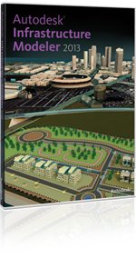
| 《基礎設施概念設計》(Autodesk Infrastructure Modeler )V2013 Win32[壓縮包] | |
|---|---|
| 下載分級 | 软件资源 |
| 資源類別 | 行業軟件 |
| 發布時間 | 2017/7/11 |
| 大 小 | - |
《基礎設施概念設計》(Autodesk Infrastructure Modeler )V2013 Win32[壓縮包] 簡介: 中文名 : 基礎設施概念設計 英文名 : Autodesk Infrastructure Modeler 資源格式 : 壓縮包 版本 : V2013 Win32 發行時間 : 2012年 制作發行 : Autodesk, Inc. 地區 : 美國 語言 : 英文 簡介 : 語言:英語 網址:http://usa.autodesk.com/adsk/servlet/
"《基礎設施概念設計》(Autodesk Infrastructure Modeler )V2013 Win32[壓縮包]"介紹
中文名: 基礎設施概念設計
英文名: Autodesk Infrastructure Modeler
資源格式: 壓縮包
版本: V2013 Win32
發行時間: 2012年
制作發行: Autodesk, Inc.
地區: 美國
語言: 英文
簡介:
語言:英語
網址:http://usa.autodesk.com/adsk/servlet/pc/index?id=17276659&siteID=123112
類別:基礎設施概念設計
(from:autodesk.com.cn)
Autodesk Infrastructure Modeler 概念設計軟件可快速創建、評估和傳達項目建議方案,幫助地理信息系統(GIS)、規劃和土木工程專業人士在既定條件下評估未來的基礎設施。
Autodesk Infrastructure Modeler 是基礎設施概念設計軟件解決方案,能幫助業內專業人士快速生成令人信服的項目建議方案,從而更快速地獲得利益相關方的認可,並更自信地制定決策。Autodesk Infrastructure Modeler 能幫助用戶創建出真實再現自然和建築環境的模型,在一個模型中評估多個項目概念設計,並將視覺效果形象、逼真的建議方案傳達給利益相關方。
Autodesk Infrastructure Modeler 是原 Autodesk LandXplorer Studio Professional 的後續下一版本新的命名。整合多維的設計信息、空間信息、建築施工信息和業務管理信息;通過設計、可視化、模擬和分析,幫助專業人員在基礎設施建設項目的規劃設計過程中提高工作效率,確保項目過程中各個團隊的協作,提升新建系統的設計水平,並且更為高效地管理已建成的基礎設施。
“借助於Autodesk Infrastructure Modeler軟件,我們只需兩個小時就能利用初始設計數據為一個大型山坡總體規劃項目的建議方案制作項目介紹,並對其進行分析。如果采用傳統做法,同樣的流程需要兩個星期或更長時間,”VTN咨詢公司(VTN Consulting)的BIM/虛擬設計技術經理Keith Warren介紹。VTN公司為公共和私營部門提供全方位的工程、規劃、地理信息系統及BIM優質服務。
=======================================
下載鏈接來自STF
未經過安裝測試與安全檢測,使用者後果自負與本論壇無關
軟體版權歸原作者及其公司所有,如果你喜歡,請購買正版
=======================================
Autodesk® Infrastructure Modeler software for urban planning design helps civil engineering, transportation, and urban planning professionals create, evaluate, and communicate infrastructure proposals. Infrastructure Modeler can help to drive stakeholder buy-in and inform decision making with visually rich proposals for transportation, land, water, and energy infrastructure projects.
Model existing infrastructure—Bring 2D CAD, GIS, Building Information Modeling (BIM), and raster data into a 3D model.
Import detailed models—Incorporate detailed models from AutoCAD® Civil 3D® 2012, AutoCAD® Map 3D 2012, and other software.
Overlay GIS data—Create 3D thematic maps to help inform decisions.
Manage infrastructure proposals—Create and manage multiple alternatives in a single model.
Powerful sketching tools—Sketch conceptual designs directly into a model.
Communicate visually rich infrastructure proposals—Shift between design proposals and evaluate alternatives, and capture rendered images or recorded videos.
代碼
AUTODESK INFRASTRUCTURE MODELER 2013
WINDOWS 32BIT
date: April 05, 2012
type: CAD
size: DVD 20x100mb
Description:
˜˜˜˜˜˜˜˜˜˜˜˜
Autodesk Infrastructure Modeler software for urban planning
design helps civil engineering, transportation, and urban
planning professionals create, evaluate, and communicate
infrastructure proposals. Infrastructure Modeler can help
to drive stakeholder buy–in and inform decision making with
visually rich proposals for transportation, land, water, and
energy infrastructure projects.
http://www.autodesk.com
Installation:
˜˜˜˜˜˜˜˜˜˜˜˜˜
Unpack, burn or mount with D–Tools & install.
Check Crack/install.txt on DVD1
Enjoy!
相關資源:


- [多媒體類]《照片級3D渲染》(Autodesk ImageStudio 2008)[ISO]
- [多媒體類]《三維動畫設計建模》(DAZ 3D Carrara 6 Pro With Extras content files)[ISO]
- [行業軟件]《歐特克三維機械設計軟件》(Autodesk Inventor Pro v2011)Win32[光盤鏡像]
- [網絡軟件]《 YouTube視頻下載工具》(Litex Media Youtube Video Grabber)v1.9.9[壓縮包]
- [應用軟件]《基於MD5算法的文件完整性檢查工具》(MD5 Checksum Verifier)v3.9/含破解文件[壓縮包]
- [應用軟件]《電子書制作軟件》(Anthemion Jutoh)v1.30[壓縮包]
- [編程開發]《finalRender Stage
- [安全相關軟件]《木馬清除程序》(Anti-Trojan Elite )v5.5.9[壓縮包]
- [多媒體類]《電影動效》(Ueberschall.Liquid.Instruments.Score.FX)1.5.23[光盤鏡像]
- [行業軟件]《中醫針灸診療訓練管理軟件》(ShenProfessional)V3.0[壓縮包]
- [人文社科]《佛說四十二章經淺釋》掃描版[PDF]
- [文學圖書]《伊托邦:數字時代的城市生活》((美)威廉﹒J﹒米切爾)掃描版[PDF]
- [其他圖書]《最新版電子佛典集成(大正藏 卍續藏 嘉興藏等
- [硬盤游戲]《極性》(Polarity)英文硬盤版[壓縮包]
- [行業軟件]《高級疲勞耐久性分析》(ANSYS DesignLife 13.0)WIN32+WIn64[光盤鏡像]
- [電子雜志]《普益財富周刊》更新至2010年5月28日[ZUB] 資料下載
- [應用軟件]《e-learning課件制作工具Articulate Studio 09 Pro》(Articulate Studio 09 Pro)2009 Pro[安裝包]
- [小說圖書]《插圖本東周列國志》掃描版[PDF]
- [人文社科]《邏輯學是什麼》(WHAT IS LOGIC?)(陳波)掃描版[PDF]
- [其他圖書]《法國帝國時期軍服》(Uniforms Of the Armies Of France 1690-1894)
- 《Vicon運動捕捉系統》(Vicon Blade)v1.7/含注冊[壓縮包]
- 《MAGMA SOFT鑄造仿真軟件》(MAGMASOFT.V4.4)V4.4[光盤鏡像]
- 《機械工程師CAD2010》(inkcad.機械工程師CAD2010)2010第一版[光盤鏡像]
- Zbrushcore免費下載zbrush4r7簡化中文版
- 《電路設計與仿真軟件(暫無官方中文名)》(Electronics Workbench Multisim 9)v9.0.155[壓縮包],行業軟件、資源下載
- 《PTC Pro/ENGINEERWildfire4.0 M100 - Win32位多國語言版》[光盤鏡像]》》(PTC Pro/ENGINEERWildfire4.0 M100 a multili
- 《鋼結構詳圖設計系統》(ACECAD STRUCAD)V11.0[Bin]
- 《電子設計套件工具》(Xilinx ISE Design Suite )v12.3/WIN[光盤鏡像]
- 《STAR-CCM+ v3.06 通用熱流體分析軟件》(CD-adapco Star-CCM Plus and Cad Series v3.06)Linux32,Linux64,Windows32,W
- 《甲骨文數據庫 11g Release 1》(Oracle Database 11g Release 1)For Windows X86[壓縮包],行業軟件、資源下載
- 《Altium Designer Summer 08》(Altium Designer Summer 08)2008
- 《安裝程序制作軟件》(InstallBuilder-Enterprise Site)v6.1.2[壓縮包]
免責聲明:本網站內容收集於互聯網,本站不承擔任何由於內容的合法性及健康性所引起的爭議和法律責任。如果侵犯了你的權益,請通知我們,我們會及時刪除相關內容,謝謝合作! 聯系信箱:[email protected]
Copyright © 電驢下載基地 All Rights Reserved