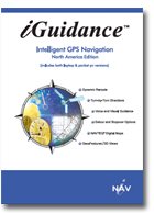
資料介紹

已通過殺毒軟件檢測:卡巴斯基
已經過運行測試,測試平台: Windows XP SP2 英文版
共享服務時間:不定時
軟件相關資料:http://www.inavcorp.com
光盤內原資源版權歸原作者及公司,如果你喜歡,請購買正版光盤
Routing
* New! Multiple stopover/waypoints
* New! Itinerary planning (user-defined trip order)
* New! Detour by distance or avoid road
* New! Shortcuts to "Home" (user-defined) & POI subcategories (program default)
* New! Trip status box displaying ETA, distance, remaining time, and speed simultaneously
* New! Trip computer displaying start/end time, total distance traveled, average & top speed
* Enhanced memory management for longer distance routing *see note below
* Improved bluetooth connectivity
* 4 pre-defined map color themes
* Single click POI navigation from onscreen icon (name/phone displayed if available)
* Real time weather report (internet access required via LAN, BT, mobile phone, Wi-Fi, etc)
* Turn-by-turn visual instructions with voice prompts
* Search by city or street first, intersection, city center, POI, LAT/LON (PPC only), Outlook contacts (PPC & U.S. addresses only), favorites, and recent
* Over 1.4 million POI destinations with subcategories (listed by alphabetical order, distance, or city)
* Maneuver guidance screen
* Route list display
* Quickest, shortest, local, major, ferry, toll, and carpool route options
* Automatic day/night map color switching
* Record and play route/track
* Customizable hotkeys for quick command (for PDA)
* Default (non-customizable) hot keys for quick command (for laptop)
* Automatic & dynamic rerouting for wrong turns
* Special safety features (speed and fog alert)
* Easy to use keypad for name entry
*User needs to load maps for all states passing through. Total route distance capability will be limited to SD/CF card memory capacity.
Map
* New! Updated Navteq map now including Alaska & Nunavut province
* Easily select map region by state, region, or by city/radius
* Detailed map display w/ street names in 2D & 3D view
* Zoom in and out
Visual Display
* New! New GUI w/ enlarged menu buttons & font size
* New! UMPC/Car PC version bundled
* New! Bordered roads
* New! Railroads & major roads marking
* New! Enhanced 3D display
* New! 240x240 square screen support
* VGA & landscape view support
* Full screen mode for laptop
* Geo-features differentiating lands, body of water, airport, etc
* Full screen mode for pocket pc and laptop
* Large finger accessible buttons
* Intuitive menu options
* Distance indication bar
* Automatic color modes for day and night display
* Bright colors for visual enhancement
Voice
* Turn-by-turn voice prompts
* Side of street & fwy # notification
* Automatic voice alerts before each turn/exit
* Repeat voice direction feature
* Multiple distance notification for each maneuver
Map
US State Map Coverage
Alabama 45mb
Alaska 23mb
Arizona 41mb
Arkansas 37mb
California 144mb
Colorado 44mb
Connecticut 16mb
Delaware 7mb
District of Columbia 3mb
Florida 98mb
Georgia 64mb
Hawaii 6mb
Idaho 28mb
Illinois 64mb
Indiana 43mb
Iowa 32mb
Kansas 33mb
Kentucky 41mb
Louisiana 37mb
Maine 18mb
Maryland 27mb
Massachusetts 29mb
Michigan 60mb
Minnesota 45mb
Mississippi 32mb
Missouri 54mb
Montana 31mb
Nebraska 24mb
Nevada 25mb
New Hampshire 12mb
New Jersey 36mb
New Mexico 37mb
New York 72mb
North Carolina 66mb
North Dakota 19mb
Ohio 63mb
Oklahoma 36mb
Oregon 64mb
Pennsylvania 74mb
Rhode Island 6mb
South Carolina 40mb
South Dakota 19mb
Tennessee 51mb
Texas 141mb
Utah 24mb
Vermont 10mb
Virginia 53mb
Washington 53mb
West Virginia 25mb
Wisconsin 46mb
Wyoming 21mb
Canada State Map Coverage
Alberta 21mb
British Columbia 23mb
Manitoba 13mb
New Brunswick 10mb
Newfoundland & Labrador 6mb
Northwest Territories 4mb
Nova Scotia 8mb
Nunavut 3mb
Ontario 50mb
Prince Edward Island 1mb
Quebec 43mb
Saskatchewan 20mb
Yukon Territory 3mb
*Map data size approx. 2.3GB
Compatibility
* Software includes pocket PC, laptop, & UMPC/AutoPC versions!
* Main program: 12MB (PPC); 64MB (laptop/UMPC)
* Map data size: 2.3GB
* Compatible Operating Systems:
o PC version: Windows ME/NT/2000/XP (not compatible w/ Windows MCE)
o PPC version: Windows Mobile 2003/2003SE, WM5.0
* Pocket PC's/Pocket PC Phones:
Dell Garmin iQue** HP iPAQ iMate
Mitek (not A701) NEC Siemens Palm Treo 700W
Viewsonic
& various PPC Phones (HP 6500/6900, Samsung i730, PPC 6600/6700, Cingular 8125, 9100, etc)***
*Note: certain models within the brand might not be compatible. Please verify with manufacturers or iNav.
**Note: compatible Garmin iQues include M3, M4, M5
***Note: not compatible w/ PPC/PPC phones w/o touch screen support
*
Receivers:
iGuidance works with any GPS receivers that are based on the NMEA protocol using RS232, USB, CF, or bluetooth interface. USB-based receivers must come with an USB-to-Serial bridge driver that is Microsoft certified in order to work with iGuidance on your laptop. This driver is provided by the gps receiver manufacturer. *For USG SDIO-502 receiver, please generate map to laptop/PC C:/ drive first and then copy over to SD card.
*
Minimum System Requirements:
Laptop: DVD/CD ROM drive, USB port, minimum 256MB memory, PII CPU or above
PPC: ARM CPU ONLY, minimum 64MB on-board memory
 《探索Maya 2011動畫制作:攀登牆的過程視頻教程》(Digital Tutors Exploring Animation in Maya 2011: Climbing A Wall )[光盤鏡像]
- [安全相關軟件]大蜘蛛Dr.Web Security Space 6.00.1.05040 + KEY授權文件[軟件]
- [行業軟件]《寵物商店管理軟件》(123Pet)v9.0.2.1096[壓縮包]
- [系統工具]《蘋果最新系統10.5 Leopard》(Mac OS X LEOPARD)10.5
- [操作系統]《Mandriva》(Mandriva
- [系統工具]《數據恢復軟件》(WinMend.Data.Recovery)v1.3.5[壓縮包]
- [應用軟件]《MSC 仿真分析工具》(MSC Easy5 v2008 R1)[ISO]
- [應用軟件]谷歌金山詞霸合作版
- [應用軟件]《UltraEdit 老牌專業編輯器》 v16.00.0.1025 簡體中文漢化增強版[安裝包]
- [操作系統]企業搜索引擎實戰之Solr與ELKStack第一期視頻教程
- [編程開發]《基於Python語言開發環境》(Wingware.WingIDE.Professional)v3.2.3.1[壓縮包]
- [文學圖書]《中日文化沖突與理解的事例研究》(尚會鵬&徐晨陽)掃描版[PDF]
- [小說圖書]《午夜陽光》掃描版[PDF]
- [經濟管理]《阿裡巴巴正傳》掃描版[PDF]
- [電腦基礎]190T資源大放送!
- [操作系統]《操作系統 KNOPPIX中文版》(KNOPP LINUX)[ISO]
- [行業軟件]《Allegro系統互連設計平台》(Cadence.Allegro Silicon Package Board)16.30(Linux版)[壓縮包]
- [硬盤游戲]《亞當之歷險2:所羅門王的秘密》(Adams Venture 2: Solomons Secret)完整硬盤版[壓縮包]
- [操作系統]《操作系統 KNOPPIX中文版》(KNOPP LINUX)[ISO]
- [小說圖書]《未來都市NO.6》(未來都市NO.6)
- [人文社科]《秘密》(The Secret)清晰掃描版[PDF]
- 《EDIUS4.6簡體中文全功能版附TM pro字幕插件及視頻教程》(Canopus_Edius_Pro_4.6)4.6中文全功能版[ISO],應用軟件、資源下載
- 《軟件升級之星》(UpdateStar.Premium)v6.0.1036[壓縮包]
- 《巴比倫翻譯專家8.0》(Babylon8.0)8.0[壓縮包]
- 《標簽大師v5.0》(Labels Master 5.0)光盤版,光盤直接運行免安裝[ISO]
- 《TuneUp.Utilities.2004.4.1.2316簡體中文漢化注冊版》(TuneUp.Utilities.2004.4.1.2316)
- 《高性能仿真器》(Fintronic Super FinSim)v8.1[Bin],應用軟件、資源下載
- 《開放源碼的數值計算平台》(Scilab)5.3.1[安裝包]
- 《iPad、iPhone專用備份轉檔軟體》(Wondershare iMate)v1.0.4/含注冊機[壓縮包]
- 《PDF制作軟件》(ITekSoft eDocPrinter PDF Pro)專業版v6.68.5772/x86+x64/含注冊機[壓縮包]
- 《CAD工具》(DDS PARTNER)V6.34[Bin],應用軟件、資源下載
- 微軟出品的《德英詞典》(LexiROM 4.0 Edition 2000)[ISO]
- 《甲天下實用工具光盤 勞動的結晶》眾人聯合打造[ISO],應用軟件、資源下載
免責聲明:本網站內容收集於互聯網,本站不承擔任何由於內容的合法性及健康性所引起的爭議和法律責任。如果侵犯了你的權益,請通知我們,我們會及時刪除相關內容,謝謝合作! 聯系信箱:[email protected]
Copyright © 電驢下載基地 All Rights Reserved


