《可視化GPS地圖操作工具》(GPSMapEdit )v1.0.66.7[壓縮包] 簡介: 中文名 : 可視化GPS地圖操作工具 英文名 : GPSMapEdit 資源格式 : 壓縮包 版本 : v1.0.66.7 發行時間 : 2010年 制作發行 : Konstantin Galichsky 語言 : 英文 簡介 : Geopainting GPSMapEdit 一款支持下列圖形格式的可視化的GPS地圖操作工具: Garmin MapSource(G
電驢資源下載/磁力鏈接資源下載:
全選
"《可視化GPS地圖操作工具》(GPSMapEdit )v1.0.66.7[壓縮包]"介紹
中文名: 可視化GPS地圖操作工具
英文名: GPSMapEdit
資源格式: 壓縮包
版本: v1.0.66.7
發行時間: 2010年
制作發行: Konstantin Galichsky
語言: 英文
簡介:

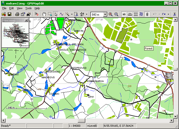
Geopainting GPSMapEdit 一款支持下列圖形格式的可視化的GPS地圖操作工具:
Garmin MapSource(Garmin制圖格式)
Polish format (text files accepted by cGPSmapper.exe)
ALAN Map 500 (ALAN Map 500 GPS接收機制圖格式)
Holux (Holux Technology Inc. 公司產品的制圖格式)
GIS Russa (GIS Russa公司產品的制圖格式)
等多種GPS地圖格式。
This software is designed for visual authoring of GPS-maps in various proprietary cartographic formats:
Garmin MapSource,
Polish format (input files for cGPSmapper.exe),
Lowrance MapCreate,
ALAN Map 500/600,
Holux MapShow,
Navitel Navigator (navigation software for Windows Mobile, Android, Symbian, iPhone),
and custom POIs and speedcams for Garmin POI Loader, TomTom OV2, Nav N Go iGO, Navitel Navigator.
Platform: MS Windows 98, ME, 2000, XP, Vista, Windows 7.
GUI language: English (U.S.), Portuguese (Brazil), Russian, Persian,


New feature: Exporting bookmarks to comma-separated values table (.CSV) (menu item 'File | Export | Bookmarks to | Comma-separated text file (*.csv)'). Each type of bookmarks is exported to separate .CSV file into the folder selected by user.
New feature: New types of bookmarks are introduced: "Custom POI" (custom POIs for Garmin POI Loader and TomTom OV2), "Speed camera" (speedcams for Garmin POI Loader and iGO).
New feature: Import and export of custom POIs and speedcams in the format of Garmin POI Loader .CSV as bookmarks of the corresponding types mentioned above.
New feature: Import and export of custom POIs in the format TomTom .OV2 as bookmarks of the type "Custom POI".
New feature: Import and export of speedcams in the .TXT format for iGO as bookmarks of the type "Speed camera".
Enhancement: In the window "Properties" for bookmarks, the support of TAB, SHIFT+TAB, UP, DOWN buttons is added.
Enhancement: In the window "Properties" for bookmarks, the "Time" field is added to define exact time associated with bookmark. (NOTE: The time is stored inside .MP file as GMT, and it is converted to local time before showing it.)
New feature: New menu item 'View | Camera View' shows tool for capturing JPEG image from external or built-in camera. If GPS positioning is turned on, image is saved with current position in the EXIF header.
NOTE: This feature requires license key. In demo mode, the function is availabe during 1 minute from the first using after every launching GPSMapEdit.
The camera must support Microsoft DirectShow. Image is captured in the resolution of current video stream (high-definition photo resolution, if any, is not supported). The photo taking is not available under Windows 98/2000.
Enhancement: In the window "Properties" for bookmarks with type "File link/Photo", the button for taking photograph from camera is added. Depending on the settings, the reference to the image file may be stored by absolute path as well as by relative one to current map.
Enhancement: Toolbar may have multiple lines of buttons depending on the width of the main window.
Enhancement: GUI localization for Portuguese (Brazil) (translated by Camilo Barreto) and Persian (translated by Farhad Kiani) is available.
Enhancement: Mirrored GUI for Middle East languages (e.g. Arabic, Persian, Hebrew) is supported. In this update, mirrored GUI is available for Persian.
Enhancement: Translation of type names in German, Russian and Spanish is updated for the type sets "Garmin" and "Navitel".
Enhancement: Translation of type names for the type sets "Garmin" and "Navitel" is added for 28 new languages.
Enhancement: New transliteration table (the file .\_Transliteration\trans-pl.dat) for Polish to Latin is added (thanks to Ar't).
Enhancement: In the settings, 'Common' tab, the list "Interface language" now shows additionally all the languages the type names translated to, in combination with English (U.S.) for the main GUI interface.
Enhancement: Localized type names are shown everywhere in GPSMapEdit instead of former type names in English. In the window "Select Type", the column with type names in English is preserved, but as complimentary one to the column with localized type names.
Enhancement: All the files type-*.dat responsible for type names translation are moved to the subfolder .\_Types. All these files are now encoded in UTF-8 (however ANSI encoding is still supported too.)
Enhancement: New menu item 'View | Outline Labels' shows/hides the outline for labels (thanks to Doozer).
Fix: Automatic selection of color for label outlining is fixed.
Fix: On menu item 'Edit | Select | By Type...', the button "OK" is enabled initially for the list of types (thanks to Mik.RU).
Fix: Crash while exporting some of maps to format .NM2 for Navitel 3.2.6 (thanks to Peyo Labov, autostavrroute).
Fix: Menu item 'View | Show Labels' now affects bookmarks.
Fix: Menu item 'View | Show Numbers along Roads' now affects selected road (thanks to Gary Turner).
Enhancement: In the tool 'Edit Points', the inner area of selected polygons is not outlined. Instead, only contour is outlined (thanks to L_G).
Fix: Copying bookmarks in some cases.
Fix: Sorting of some columns in some lists (e.g. the list of attached files) now is case-insensitive (thanks to vasketsov).
Fix: Sticking of polyline and polygon points is not applied to neighbour note drawings (thanks to Doozer).
Enhancement: Automatic resizing of the in-place edit box for labels (thanks to topograf).
Enhancement: The projection "EPSG:3395" is supported for .ECW format (thanks to topograf).
Fix: Crash while viewing some of EXIF photographs (thanks to Evgeniy Ukhanov).
Enhancement: Before pasting from clipboard, warning about inconsistent set of zoom levels is shown (thanks to Ar't).
New feature: Converting polyline to note drawing (context menu item 'Modify | Kind | Convert to Note Drawing') (thanks to Dr. .
.
New feature: Converting waypoint to bookmark (context menu item 'Convert to | Bookmark...').
Enhancement: In the list of cities, new column "Locatable" is added. It shows is there a point object indexed as corresponding city.
Enhancement: The appearnce of "Verify Map" window is changed: the set of available checks is now shown as tree; all the checks are sorted by categories.
Enhancement: The list of checks in "Verify Map" is extended by new checks of map header, labels, cities etc. For maps with the type set "Garmin", new "Check for limit of 60 routing nodes per road" is added (thanks to Jan Vanslembrouck).
|||||||||||||||||||||||||||||||||||||||||||||||||||||||||||||||||||||||||||||||||||||||||||||||||||||||||||||||||||||||||||||||||||||||||||||||||||||||||||||||||||||||||||||||||||||||||||||||||||||||||||||
更多資訊請點擊訪問

|||||||||||||||||||||||||||||||||||||||||||||||||||||||||||||||||||||||||||||||||||||||||||||||||||||||||||||||||||||||||||||||||||||||||||||||||||||||||||||||||||||||||||||||||||||||||||||||||||||||||||||
本資源下載鏈接來自ShareVirus
代碼
t h e c r a c k e r s o f
²² ² ² ²²²
²²²² ²²
² ²
² ²
² ² ²²
²²
[rAD!s] ² ² ² ²
²²² ²²
² ² ²² ² ²²² ²²
²² ²
² ²
p r e s e n t t h e 2 0 k - c o l l e c t i o n
² ² ² ²
GPSMapEdit v1.0.66.7 *INCL.KEYMAKER*
Cracked by....: Cyrex Release-Name..: CR-GME17.ZIP
Supplied......: CORE Release-Date..: 2010/12/05
Packaged......: CORE Release-Type..: Util
² Protection....: Serial OS............: Windows ²
Crack/SN......: Keymaker Language......: English
Rating........: [You decide!] Disks.........: 01
² ²
² ²
² ²
² ²
°² ²°
±± ±±
² ²² ²² ²
²± ²² ²² ±²
²²²² ² ² ²²²²
° °
°
°² ²°
²
² ² ²
²± ±² ²°
°² ²²²² ²²²²
²°
°² ²
² ..: DESCRiPTiON :.. ²
² ²
² ²
² This software is designed for visual authoring of GPS-maps in ²
² various proprietary cartographic formats: ²
² ²
² * Garmin MapSource, ²
² * Polish format (input files for cGPSmapper.exe), ²
² * Lowrance MapCreate, ²
² * ALAN Map 500/600, ²
² * Holux MapShow, ²
² * Navitel Navigator (navigation software for Windows Mobile, ²
² Android, Symbian, iPhone), ²
² * and custom POIs and speedcams for Garmin POI Loader, TomTom ²
² OV2, Nav N Go iGO, Navitel Navigator. ²
² ²
² http://www.geopainting.com/ ²
² ²
² ²
° °
± ±
² ²
°² ²°
°² ..: iNSTALL/REGiSTER NOTES :.. ²°
² ²
² ²
² ²
² Use our keymaker to register the application. ²
² ²
² GUI language: English (U.S.), Portuguese (Brazil), Russian, ²
² Persian. ²
² ²
² ²
² ²
² ²
² Thanks for choosing ²
² (C)hallenge (O)f (R)everse (E)ngineering! ²
² ²
² ²
² ²
² ²²
² ²
²± ±² ²°
°² ²²²² ²²²²
²°
°² ²
..: CORE NEWS AND iNFOS :..
² ²
² - not available - ²
²² ²²
² ²
² ²
² ²
² ²
²
² ²
² ²
² ²
² ²
² ²
² ²
² ²
² ²
² ² ² ²
² ²
² ²
² ²
² ²
lAYOUt & hEADER bY. [rAD!s]
nfO UPdATED ON [2010/01/01]
(c) C.O.R.E. 2 0 1 0
ת CRC 7DAE:7686
英文名: GPSMapEdit
資源格式: 壓縮包
版本: v1.0.66.7
發行時間: 2010年
制作發行: Konstantin Galichsky
語言: 英文
簡介:
Geopainting GPSMapEdit 一款支持下列圖形格式的可視化的GPS地圖操作工具:
Garmin MapSource(Garmin制圖格式)
Polish format (text files accepted by cGPSmapper.exe)
ALAN Map 500 (ALAN Map 500 GPS接收機制圖格式)
Holux (Holux Technology Inc. 公司產品的制圖格式)
GIS Russa (GIS Russa公司產品的制圖格式)
等多種GPS地圖格式。
This software is designed for visual authoring of GPS-maps in various proprietary cartographic formats:
Garmin MapSource,
Polish format (input files for cGPSmapper.exe),
Lowrance MapCreate,
ALAN Map 500/600,
Holux MapShow,
Navitel Navigator (navigation software for Windows Mobile, Android, Symbian, iPhone),
and custom POIs and speedcams for Garmin POI Loader, TomTom OV2, Nav N Go iGO, Navitel Navigator.
Platform: MS Windows 98, ME, 2000, XP, Vista, Windows 7.
GUI language: English (U.S.), Portuguese (Brazil), Russian, Persian,
New feature: Exporting bookmarks to comma-separated values table (.CSV) (menu item 'File | Export | Bookmarks to | Comma-separated text file (*.csv)'). Each type of bookmarks is exported to separate .CSV file into the folder selected by user.
New feature: New types of bookmarks are introduced: "Custom POI" (custom POIs for Garmin POI Loader and TomTom OV2), "Speed camera" (speedcams for Garmin POI Loader and iGO).
New feature: Import and export of custom POIs and speedcams in the format of Garmin POI Loader .CSV as bookmarks of the corresponding types mentioned above.
New feature: Import and export of custom POIs in the format TomTom .OV2 as bookmarks of the type "Custom POI".
New feature: Import and export of speedcams in the .TXT format for iGO as bookmarks of the type "Speed camera".
Enhancement: In the window "Properties" for bookmarks, the support of TAB, SHIFT+TAB, UP, DOWN buttons is added.
Enhancement: In the window "Properties" for bookmarks, the "Time" field is added to define exact time associated with bookmark. (NOTE: The time is stored inside .MP file as GMT, and it is converted to local time before showing it.)
New feature: New menu item 'View | Camera View' shows tool for capturing JPEG image from external or built-in camera. If GPS positioning is turned on, image is saved with current position in the EXIF header.
NOTE: This feature requires license key. In demo mode, the function is availabe during 1 minute from the first using after every launching GPSMapEdit.
The camera must support Microsoft DirectShow. Image is captured in the resolution of current video stream (high-definition photo resolution, if any, is not supported). The photo taking is not available under Windows 98/2000.
Enhancement: In the window "Properties" for bookmarks with type "File link/Photo", the button for taking photograph from camera is added. Depending on the settings, the reference to the image file may be stored by absolute path as well as by relative one to current map.
Enhancement: Toolbar may have multiple lines of buttons depending on the width of the main window.
Enhancement: GUI localization for Portuguese (Brazil) (translated by Camilo Barreto) and Persian (translated by Farhad Kiani) is available.
Enhancement: Mirrored GUI for Middle East languages (e.g. Arabic, Persian, Hebrew) is supported. In this update, mirrored GUI is available for Persian.
Enhancement: Translation of type names in German, Russian and Spanish is updated for the type sets "Garmin" and "Navitel".
Enhancement: Translation of type names for the type sets "Garmin" and "Navitel" is added for 28 new languages.
Enhancement: New transliteration table (the file .\_Transliteration\trans-pl.dat) for Polish to Latin is added (thanks to Ar't).
Enhancement: In the settings, 'Common' tab, the list "Interface language" now shows additionally all the languages the type names translated to, in combination with English (U.S.) for the main GUI interface.
Enhancement: Localized type names are shown everywhere in GPSMapEdit instead of former type names in English. In the window "Select Type", the column with type names in English is preserved, but as complimentary one to the column with localized type names.
Enhancement: All the files type-*.dat responsible for type names translation are moved to the subfolder .\_Types. All these files are now encoded in UTF-8 (however ANSI encoding is still supported too.)
Enhancement: New menu item 'View | Outline Labels' shows/hides the outline for labels (thanks to Doozer).
Fix: Automatic selection of color for label outlining is fixed.
Fix: On menu item 'Edit | Select | By Type...', the button "OK" is enabled initially for the list of types (thanks to Mik.RU).
Fix: Crash while exporting some of maps to format .NM2 for Navitel 3.2.6 (thanks to Peyo Labov, autostavrroute).
Fix: Menu item 'View | Show Labels' now affects bookmarks.
Fix: Menu item 'View | Show Numbers along Roads' now affects selected road (thanks to Gary Turner).
Enhancement: In the tool 'Edit Points', the inner area of selected polygons is not outlined. Instead, only contour is outlined (thanks to L_G).
Fix: Copying bookmarks in some cases.
Fix: Sorting of some columns in some lists (e.g. the list of attached files) now is case-insensitive (thanks to vasketsov).
Fix: Sticking of polyline and polygon points is not applied to neighbour note drawings (thanks to Doozer).
Enhancement: Automatic resizing of the in-place edit box for labels (thanks to topograf).
Enhancement: The projection "EPSG:3395" is supported for .ECW format (thanks to topograf).
Fix: Crash while viewing some of EXIF photographs (thanks to Evgeniy Ukhanov).
Enhancement: Before pasting from clipboard, warning about inconsistent set of zoom levels is shown (thanks to Ar't).
New feature: Converting polyline to note drawing (context menu item 'Modify | Kind | Convert to Note Drawing') (thanks to Dr.
. New feature: Converting waypoint to bookmark (context menu item 'Convert to | Bookmark...').
Enhancement: In the list of cities, new column "Locatable" is added. It shows is there a point object indexed as corresponding city.
Enhancement: The appearnce of "Verify Map" window is changed: the set of available checks is now shown as tree; all the checks are sorted by categories.
Enhancement: The list of checks in "Verify Map" is extended by new checks of map header, labels, cities etc. For maps with the type set "Garmin", new "Check for limit of 60 routing nodes per road" is added (thanks to Jan Vanslembrouck).
|||||||||||||||||||||||||||||||||||||||||||||||||||||||||||||||||||||||||||||||||||||||||||||||||||||||||||||||||||||||||||||||||||||||||||||||||||||||||||||||||||||||||||||||||||||||||||||||||||||||||||||
更多資訊請點擊訪問
|||||||||||||||||||||||||||||||||||||||||||||||||||||||||||||||||||||||||||||||||||||||||||||||||||||||||||||||||||||||||||||||||||||||||||||||||||||||||||||||||||||||||||||||||||||||||||||||||||||||||||||
本資源下載鏈接來自ShareVirus
代碼
t h e c r a c k e r s o f
²² ² ² ²²²
²²²² ²²
² ²
² ²
² ² ²²
²²
[rAD!s] ² ² ² ²
²²² ²²
² ² ²² ² ²²² ²²
²² ²
² ²
p r e s e n t t h e 2 0 k - c o l l e c t i o n
² ² ² ²
GPSMapEdit v1.0.66.7 *INCL.KEYMAKER*
Cracked by....: Cyrex Release-Name..: CR-GME17.ZIP
Supplied......: CORE Release-Date..: 2010/12/05
Packaged......: CORE Release-Type..: Util
² Protection....: Serial OS............: Windows ²
Crack/SN......: Keymaker Language......: English
Rating........: [You decide!] Disks.........: 01
² ²
² ²
² ²
² ²
°² ²°
±± ±±
² ²² ²² ²
²± ²² ²² ±²
²²²² ² ² ²²²²
° °
°
°² ²°
²
² ² ²
²± ±² ²°
°² ²²²² ²²²²
²°
°² ²
² ..: DESCRiPTiON :.. ²
² ²
² ²
² This software is designed for visual authoring of GPS-maps in ²
² various proprietary cartographic formats: ²
² ²
² * Garmin MapSource, ²
² * Polish format (input files for cGPSmapper.exe), ²
² * Lowrance MapCreate, ²
² * ALAN Map 500/600, ²
² * Holux MapShow, ²
² * Navitel Navigator (navigation software for Windows Mobile, ²
² Android, Symbian, iPhone), ²
² * and custom POIs and speedcams for Garmin POI Loader, TomTom ²
² OV2, Nav N Go iGO, Navitel Navigator. ²
² ²
² http://www.geopainting.com/ ²
² ²
² ²
° °
± ±
² ²
°² ²°
°² ..: iNSTALL/REGiSTER NOTES :.. ²°
² ²
² ²
² ²
² Use our keymaker to register the application. ²
² ²
² GUI language: English (U.S.), Portuguese (Brazil), Russian, ²
² Persian. ²
² ²
² ²
² ²
² ²
² Thanks for choosing ²
² (C)hallenge (O)f (R)everse (E)ngineering! ²
² ²
² ²
² ²
² ²²
² ²
²± ±² ²°
°² ²²²² ²²²²
²°
°² ²
..: CORE NEWS AND iNFOS :..
² ²
² - not available - ²
²² ²²
² ²
² ²
² ²
² ²
²
² ²
² ²
² ²
² ²
² ²
² ²
² ²
² ²
² ² ² ²
² ²
² ²
² ²
² ²
lAYOUt & hEADER bY. [rAD!s]
nfO UPdATED ON [2010/01/01]
(c) C.O.R.E. 2 0 1 0
ת CRC 7DAE:7686
相關資源:


- [系統工具]《字體管理軟件》(Extensis.Suitcase.Fusion.)v13.2.0.37[壓縮包]
- [應用軟件]《PDF格式套件專業版2011》(PDF Suite Professional Edition 2011)v9.0.65.40809 英文/多語言[壓縮包]
- [編程開發]《微軟操作管理》(Microsoft Operations Manager 2005)[ISO],編程開發、資源下載
- [網絡軟件]《網絡監測工具》(Nsasoft NBMonitor Network Bandwidth Monitor)v1.3.6.0[壓縮包]
- [應用軟件]《譯典通2005專業版》(dr.eye Pro 2005)2005z最新版,可升級,應用軟件、資源下載
- [網絡軟件]《YouTube視頻下載工具》(NCH FlashLynx Video Download)v1.22[壓縮包]
- [應用軟件]《Outlook Express郵件備份軟件》(Static Outlook Express Backup)v2.9f含注冊機[壓縮包]
- [行業軟件]《CURIOUS WORLD MAPS地圖和地理動畫》(CURIOUS WORLD MAPS)V7.0[ISO]
- [應用軟件]《Zend Studio 5.1 Server + Client》(Zend Studio 5.1 Server + Client)v5.1
- [操作系統]《基於Debian的Linux
- [硬盤游戲]《綠月》(Green Moon )中文硬盤版[壓縮包]
- [人文社科]《男人成大事的9種真本事》(瀚文)掃描版[PDF]
- [小說圖書]《失樂園》(失楽園)文字版[PDF]
- [文學圖書]《湮沒的輝煌》掃描版[PDF]
- [多媒體類]《奧杜比音頻處理軟件》(Adobe Audition 3)[壓縮包]
- [硬盤游戲]《幽閉聖地2》(Sanctum 2)免安裝硬盤版[壓縮包]
- [電腦基礎]《方正飛騰基礎教程(共47集)》4.0[壓縮包]
- [系統工具]《Acronis系統備份還原工具》(Acronis True Image Home 2013) v16.0.5551 Plus Pack BootCD[壓縮包]
- [其他圖書]《刑法分論(第二版)(21世紀法學系列教材)》
- [生活圖書]《燕青拳》掃描版[PDF]
- 《PDF 游覽轉換器3.0 專業版》(ScanSoft PDF Converter v3.0 Professional),應用軟件、資源下載
- 《蓬萊2008專業版》(Horai2008professional )[光盤鏡像]
- 《諾基亞主題制作軟件3.2》(Carbide.ui 3.2 Theme Edition )
- 《世界望遠鏡》(Worldwide Telescope)官方多國語言(有中文)原版[安裝包]
- 《中國圍棋入門與提高》[ISO],應用軟件、資源下載
- 《吉他譜軟件 Guitar pro 5.2》(Guitar pro 5.2)5.2[安裝包]
- 《翻譯軟體》(Life Translator v2.7.8.551)英文版,應用軟件、資源下載
- 《辦公輔助軟件》(Office Tab Enterprise)9.51[壓縮包]
- 《網絡游戲外掛軟件》,應用軟件、資源下載
- 《Cadsoft Envisioneer v3.0 智能化建築模型設計軟件》,應用軟件、資源下載
- 《英語語言閱讀速度訓練專用軟件》(eyeQ)[光盤鏡像]
- 《字體服務軟件》(Extensis Universal Type Server Enterprise)v3.3.0[壓縮包]
免責聲明:本網站內容收集於互聯網,本站不承擔任何由於內容的合法性及健康性所引起的爭議和法律責任。如果侵犯了你的權益,請通知我們,我們會及時刪除相關內容,謝謝合作! 聯系信箱:[email protected]
Copyright © 電驢下載基地 All Rights Reserved