《矢量繪圖和GIS數據可視化解決方案》(ACD Systems Canvas with GIS+)2010[壓縮包] 簡介: 中文名 : 矢量繪圖和GIS數據可視化解決方案 英文名 : ACD Systems Canvas with GIS+ 資源格式 : 壓縮包 版本 : 2010 制作發行 : ACD Systems 地區 : 加拿大 語言 : 英文 簡介 : ACD Systems Canvas是業內著名ACD公司推出的一款頂級的矢量繪圖軟件,程序無縫集成了用於繪畫、圖像編輯和Web
電驢資源下載/磁力鏈接資源下載:
全選
"《矢量繪圖和GIS數據可視化解決方案》(ACD Systems Canvas with GIS+)2010[壓縮包]"介紹
中文名: 矢量繪圖和GIS數據可視化解決方案
英文名: ACD Systems Canvas with GIS+
資源格式: 壓縮包
版本: 2010
制作發行: ACD Systems
地區: 加拿大
語言: 英文
簡介:
ACD Systems Canvas是業內著名ACD公司推出的一款頂級的矢量繪圖軟件,程序無縫集成了用於繪畫、圖像編輯和Web設計的工具;可以以多種格式(包括動畫和Web就緒文件)導出繪畫作品,它在剪輯圖庫上捆綁了用於位圖編輯、展示、Web圖形和矢量圖繪制的工具,由於Canvas無縫集成了用於矢量插圖、圖像編輯和Web出版的功能,因此堪稱為極品。
此軟件是唯一的超值的,整合了多種解決方法,如創作,處理,描述和共享實例和圖片。
整合了實例、編輯和發布工具。
專業的繪圖特性。
超強的圖片編輯功能。
友好可變的界面
專業的發布工具,和腳本和文件格式支持。
對於任何一個設計人員,Canvas 都非常有用。它在剪輯圖庫上捆綁了用於位圖編輯、展示、Web圖形和導航圖繪制的工具。這種大集成形式的設計使Canvas變得非常實惠:價格比Adobe Illustrator便宜25美元。另外,Canvas的各種工具工作起來十分協調,來回切換十分簡單。因此,如果你正在尋找一種簡單易用的綜合圖形軟件包,Canvas可以真正地讓你實現物超所值。如果你對Canvas在Web上的應用比較感興趣,可以去看看Builder.com的評價。
可調節的界面學會使用Canvas簡直是輕而易舉,你只需要打開這個程序,選擇要創建的項目類型--插圖、出版物、動畫或者是展示,然後Canvas就會自己把相應的模板和工具拉到屏幕上。Canvas的小型工具板節省了創作時的屏幕空間,展開板上的各個按鈕又能看到大量的選項子集。如果你已經熟悉了Adobe的產品,那你可能會不太習慣Canvas斯巴達式的界面,但我們認為這款軟件設計精良,壓縮性和可定制性都比較強。
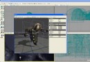
Canvas那組強大的技術繪圖工具是它最大的特點。在Canvas中你能找到CAD樣式工具常用的補充軟件,如Fillet和Trim。但是,和傳統的CAD工具不同,Canvas的工具相對而言更容易使用,這主要歸功於他們內置的咬合功能。例如,如果你想把某一對象放到圓的正中心,那你只需要在中心位置附近繪制該圖形即可,它會自動移到中心位置的。咬合功能節省了不少矢量繪圖計算工作。
時髦的特殊效果像它的競爭對手一樣,Canvas捆綁了一系列的成像過濾器(Canvas稱他們為SpriteEffect),如模糊和紋理。不過,Canvas的過濾器還有點特別,那就是應用了特殊效果後,Canvas的圖像還可以繼續編輯。最令人心動的是,Canvas讓你能夠在選定圖像的某一部分上使用透鏡工具,並在那裡應用SpriteEffect。這時,過濾器只在那一位置出現。毫無疑問,這是吸引注意力的一種極佳方法。
這一大集成的軟件包最大可能地囊括了所有做圖軟件的功能,並且集成地相當完美。對於想一次得到所有可用工具,但又不想花費太大的圖形制作專業人士來說,Canvas是一款必備的軟件。
CANVAS 是一款唯一的交叉平台,提供了(無縫集成)專家級技術圖像與圖形編輯和其它各類頁面排版、網絡圖形設計等獨特的創作工具。CANVAS 保持了18年來一貫的創新理念,這次為您帶來了超過100種以上的新特色與種種改進。
特點:
1.極佳的圖形精度(雙重浮點)
2.新的靈巧的用戶界面
3.技術圖形的專有特色
4.可擴展至更多領域
5.更多的腳本選項
6.支持更多的文件格式
Canvas 12 with GIS+ is the only GIS data visualization solution in the market that allows GIS professionals – in the oil, gas, and energy sectors, aerospace and automotive industries, education, and government – to accurately communicate the results of their research analysis inside a true graphics application. Canvas 12 with GIS+ is loaded with new tools to provide greater control over technical illustrations, enable more powerful publishing and collaboration, and streamline overall workflows. Simply import GIS project information and use Canvas 12’s powerful vector object illustration and advanced raster image editing tools to assemble, annotate and enhance your data - in one integrated, flexible design environment. Speed up and streamline your workflow from initial import and design to final presentation, facilitate collaboration, and improve overall productivity with the complete technical illustration and GIS data visualization solution.
• Handle it all – including GIS file formats
Canvas 12 with GIS+ can handle all your data import needs. In addition to the 100+ file formats, including DXF, DWG, CGM, Adobe®1 PDF, and RAW that comes standard in Canvas 12, the GIS+ module supports 18 GIS specialized file types, such as SHAPE, MapInfo and ARC/INFO. Augment, apply effects, and export to another format. You can even export to multiple formats simultaneously.
• Work flexibly with vector objects
Illustrate, edit and augment all forms of complex visual objects with Canvas 12's wide variety of professional tools and powerful Sprite technology. New features allow you to rejoin segment objects into one and fill the intersections of overlapping objects with a single click, while its proprietary SpriteLayers and SpriteEffects can be used to apply image and transparency effects without affecting the original object.
• Access raster image editing tools
Why work within limits? Canvas 12 comes complete with a full suite of raster image editing features. Create, edit and augment raster images with a host of industry standard and specialized techniques, tools and filters. Design image compositions, retouch photos, paint and color-correct scanned images, create transparency effects and vignettes, age photos, clone pixels and much more. Work with both raster images and vector images at the same time, with access to the same tools, to enhance objects and images in countless ways, all in a georeferenced environment.
• Draw and dimension with precision
Create visuals from both raw and technical data. Choose from a variety of methods to input your exact coordinates, and Canvas 12, with its ability to represent any object property to within .035 microns, accurately turns your data into strong, real-time visual content that you can then enhance, review and publish. Resize and scale objects, add fill and stroke inks, widths and other attributes, and draw shapes – all with measured precision and placement.
• Add on-the-fly illustration objects
Instantly add re-usable dynamic objects to your georeferenced work. Access hundreds of commonly used and specialized technical symbols from Canvas 12's pre-loaded Symbol Library collection, or create your own custom symbols using any vector, text or composite object. You can also create custom symbol links and pen strokes, and manage them all with flexibility. Move, add keywords, and re-categorize symbols to match your unique workflow needs.
• Make the most of your GIS data
Apply a host of image filters, transparency effects, annotation tools, image warping techniques, in addition to visual analysis and symbology tools, to create an easy-to-understand representation of your georeferenced work.
• Integrate into seismic and petrochemical workflows
Canvas 12 with GIS+ fully supports CGM*PIP files, helping increase productivity and streamline seismic-related workflows. Its CGM*PIP Import filter has received acclaim for its ability to successfully work with files from UNIX-based seismic interpretation applications. You can also import raw seismic visual data, augment, annotate, color and edit it numerically, and then combine the results with professionally formatted text in a multi-page document ready for sharing – all in a single environment. Throughout the process, illustrations and documentation retain the high level of accuracy demanded by professionals within the seismic and petrochemical industries.
• Say goodbye to distractions
Since the GIS+ module is integrated within Canvas 12, you benefit from all of its intuitive interface and customizable tool and menu options designed to make it easy to find what you need. Enjoy one stop access to inks and styles, organize your workspace to maximize productivity, and work faster with shortcuts, smart toolboxes, and interface enhancements.
• Publish your GIS data professionally
Create great-looking publications and presentations of your GIS data, in collaboration with colleagues. Canvas 12 has everything needed to design professional documents and presentations, including the Symbol Library and pre-installed Canvas symbol sets, top quality raster image rendering, robust page and text formatting, flowchart integration, and a host of pre-press tools. Apply password and encryption protection, and share your enhanced GIS data in a variety of print and Web-ready presentation formats, including HTML and Adobe® PDF complete with interactive hyperlinks.
System Requirements
Hardware
Intel® Pentium® 4 or better
512 MB RAM installed (1 GB RAM recommended)
700 MB free hard disk space (1.5 GB recommended)
16-bit color or higher (True color recommended)
1024x768 or higher screen resolution recommended
DVD drive – to install from the installer disk
Software
Microsoft® Windows® XP Home or Professional operating system (with Service Pack 2 installed), Windows Vista® or Windows® 7
Microsoft® Internet Explorer® 6.0 (7.0 or higher recommended) - to view the Help
Home Page - http://www.acdsee.com
||||||||||||||||||||||||||||||||||||||||||||||||||||||||||||||||||||||||||||||||||||||||||||||||||||||||||||||||||||||||||||||||||||||||||||||||||||||||||||||||||||||||||||||||||||||||||||||||||||||||||||||||||||||||||||||||||||||||||||||
更多資訊請點擊訪問

||||||||||||||||||||||||||||||||||||||||||||||||||||||||||||||||||||||||||||||||||||||||||||||||||||||||||||||||||||||||||||||||||||||||||||||||||||||||||||||||||||||||||||||||||||||||||||||||||||||||||||||||||||||||||||||||||||||||||||||
本資源下載鏈接來自ShareVirus
代碼
▄ ▀ ▀ ▄
▄ ▄▄█▀ ▀█▄▄ ▄
▄▀▀█▄ ▄█▀ ▄▄▀██▀ ▀██▀▄▄ ▀█▄ ▄█▀▀▄
▄ ▐█▄▀ ▄ ▀▀ ▄██▀ t h e c r a c k e r s o f ▀██▄ ▀▀ ▄ ▀▄█▌ ▄
▀▄ ███▄ ▀ ▄▄▄▀ ███ ███ ▀▄▄▄ ▀ ▄███ ▄▀
▀ ▄▄ ▀▀▀▄▀███▀ ███ ▄▄▄ ▄▄▄ ▄▄▄ ▄▄▄▄ ▄▄▄ ███ ▀███▀▄▀▀▀ ▄▄ ▀
███ ▀█▀ ███ ▄██▓▓██▄ ▄███▓██▄ ████▓██▄ ▐█▓▓███▓█▌ ███ ▀█▀ ███
███ ▀ ███ ██▓█▀▀███▌█▓██▀▀██▓█▐█▓█▀███▌ ▓▓██▀██▀▀ ███ ▀ ███
███ ███ ▐███▌ █▓█▐███▌ ▐██ ███▌ █▓█ ▐██▌ ███ ███
█████ ▐█▓█ ▐██▀▐███ ███▌███ ▄███▌██▓█▄▄▄ █████
███ ███▌ █▓█▌ ▐█▓ ▐▓███▓█▀ ▐██████▌ ███
▄█▄▄▄█▄ ▐███ ██▄▐███ ███▌███▀▀███ ▓██▓▀▀▀ ▄█▄▄▄█▄
[rAD!s] ███▀▀ ▀▀▄ █▓█▌ ▐██▌███▌ ▐▓█ █▓█ █▓█▌▐███▌▄▄ ▄▀▀ ▀▀███
██▀ ▐█▓██▄█▓█▌▐█▓██▄███▌ ███ ▐███ █▓███▓█▄ ▀██
▓██▄ ▀███▓██▀ ▀███▓▓█▀ ▐█▓█▌ ▐█▓▌▐▓██▓████▌ ▄▓█▓
▀▓▓█ ▀▀▀ ▀▀▀ ▀▀▀▀▀ ▀▀▀ ▀▀▀▀▀ █▓█▀
▓▌ ▄ ▀█▌ ▐█▀ ▄ ▐▓
▐▌ █ █▌ p r e s e n t t h e 2 0 k - c o l l e c t i o n ▐█ █ ▐▌
▓ ▓ ■▀▀ ▀▀■ ▓ ▓
▐▌ █▌ ACD Systems Canvas with GIS+ v12.0.1398 *INCL.KEYMAKER* ▐█ ▐
■ ▐█ █▌ ■
█▌ ▐█
▐█ Cracked by....: KaiZer SoZe Release-Name..: CR-9CV0S.ZIP █▌
██ Supplied......: CORE Release-Date..: 2011/01/12 ██
██▌ Packaged......: CORE Release-Type..: Util ██
█▓▌ Protection....: Serial OS............: Windows ▐▓█
▐██ Crack/SN......: Keymaker Language......: English ██▌
▐██▌ Rating........: [You decide!] Disks.........: 28 ██▌
▐██ ██▌
█▓█ █▓█
███ ▀█▄ ▄▀▀▀▄ ▄█▀ ███
███▄ ▀▄ ▄█▓▀▄▄▀ ▀▄▄▀▓█▄ ▄▀ ▄███
■ ▀█▓█▄▄ ▀▀▄▄ ▄▀▀ ▀▄ ▄▀ ▀▀▄ ▄▄▀▀ ▄▄█▓█▀ ■
▀▄▄ ▀▀█████▄ ▀▄ ▐ ▀▄▄ ▄▀ ▀▄ ▄▄▀ ▄▀ ▄█████▀▀ ▄▄▀
▀▀█▄▄▄ ▀█▓██ █ ▀ ▀▀█▄ ▄█▀▀ ▀ █ ██▓█▀ ▄▄▄█▀▀
▄ ▀▀██▀ ▀█ ■▀ ▄▀▀ ▐░▓ ▓░▌ ▀▀▄ ▀■ █▀ ▀██▀▀ ▄
▄■ ▄ ▄ ▐▌ ▒▒▌ ▐▒▒ ▐▌ ▄ ▄ ■▄
█▌ ▀ ▓▄▄▀ ▀▄▄ ▀▄▄ ▓▓█ █▓▓ ▄▄▀ ▄▀▀ ▀▄▄▓ ▀ ▐█
▐▓█▄▄▒ ▄▄▄██▀ ▀ ▄▄▓▓▀ ▀▓▓▄▄ ▀ ▀██▄▄▄ ▒▄▄█▓▌
▀▓█▓████▓▓█ ▄█▓▀ ▀▓█▄ █▓▓█████▓█▓▀
▀▀▀▀▀ ░█▀ ▀█░ ▀▀▀▀▀▀▀
░█ ▄▀▀▄ ▄▀▀▄ █
▐▌░▓▀ ▐▌ ▐▌ ▀▓░▐
▀▄ ▄▀ ▀▄ ▄▀
▀▀ ▀▀
▄■ ■▄ ▄▄▀ ▄▀▓▄
▄▓▀▄ ▀▄▄ █▌ ▀ ▓▄▄▀ ▀▄▄▓ ▀ ▐█ ▄▀▀ ▄▄▄ █
█ ▄▄▄ ▀▀▄ ▐▓█▄▄▒ ▄▄▄██▀ ▀██▄▄▄ ▒▄▄█▓▌ ▐▌ ▄▓░ ▀▀▄▄
▄▄▀▀ ░▓▄ ▐▌ ▀▓█▓████▓▓█ █▓▓█████▓█▓▀ ▀▄ ▀ ▀ ▄ ▀▄
▄▀ ▄ ▀ ▀ ▄▀ ▀▀▀▀▀ ▀▀▀▀▀▀▀ ▀▀▓░ █▀ ▐█
█▌ ▀█ ░▓▀▀ ■▀ ▓▌
▐▓ ▀■ ..: DESCRiPTiON :.. ▓▌
█▓ ▓█
█▓ ▓█
█▓ Canvas 11 with GIS+ is the only GIS data visualization solution in ▓█
█▓ today's market that addresses the need of GIS professionals to ▓█
█▓ communicate the results of their research analysis - quickly, ▓█
█▓ accurately, and effectively - inside a true graphics application. ▓█
█▓ ▓█
█▓ Simply import GIS project information and then use Canvas' image ▓█
█▓ editing, illustration, and page-layout features to create, ▓█
█▓ assemble, montage, and annotate, and enhance project data. Tasks ▓█
█▓ that previously might have required days of work - or simply could ▓█
█▓ not be accomplished with other graphics applications - can be ▓█
█▓ completed quickly and with stunning results. ▓█
█▓ ▓█
█▓ No other graphics application delivers the comprehensive set of ▓█
█▓ features and toolsets needed to make the most of your GIS ▓█
█▓ investment. ▓█
█▓ ▓█
█▓ http://www.acdsee.com ▓█
█▓ ▓█
▐▓▌▄ ▄▐▓▌
▀░▀ ▀░▀
■▀ ▀■
▀▄ ▄▄ ▄ ▄ ▄▄ ▄▀
▀ ▄ ■ ▄▀▀ ▀ ▀▒▀ ▀▒▀ ▀ ▀▀▄ ■ ▄ ▀
▐▌ ▀ ▄ ▄ ▄ ▄ ▀ ▐▌
▄▓▀▄ ▀▄▄ ▀■ ▄ ■▀ ▀■ ▄ ■▀ ▄▄▀ ▄▀▓▄
█ ▄▄▄ ▀▀▄ ▄▀▀ ▄▄▄ █
▄▄▀▀ ░▓▄ ▐▌ ▐▌ ▄▓░ ▀▀▄▄
▄▀ ▄ ▀ ▀ ▄▀ ▀▄ ▀ ▀ ▄ ▀▄
█▌ ▀█ ░▓▀▀ ..: iNSTALL/REGiSTER NOTES :.. ▀▀▓░ █▀ ▐█
▐▓ ▀■ ■▀ ▓▌
█▓ ▓█
█▓ ▓█
█▓ Use our keymaker to install the application. ▓█
█▓ ▓█
█▓ ▓█
█▓ ▓█
█▓ ▓█
█▓ Thanks for choosing ▓█
█▓ (C)hallenge (O)f (R)everse (E)ngineering! ▓█
█▓ ▓█
█▓ ▓█
▐█▓ ▓█▌
▐█▓ ▄■ ■▄ ▄▄▀ ▄▀▓▄▓█▌
▀▄ ▀▄▄ █▌ ▀ ▓▄▄▀ ▀▄▄▓ ▀ ▐█ ▄▀▀ ▄▄▄
▄▄▄ ▀▀▄ ▐▓█▄▄▒ ▄▄▄██▀ ▀██▄▄▄ ▒▄▄█▓▌ ▐▌ ▄▓░ ▀▀▄▄
▄▄▀▀ ░▓▄ ▐▌ ▀▓█▓████▓▓█ █▓▓█████▓█▓▀ ▀▄ ▀ ▀ ▄ ▀▄
▄▀ ▄ ▀ ▀ ▄▀ ▀▀▀▀▀ ▀▀▀▀▀▀▀ ▀▀▓░ █▀ ▐█
█▌ ▀█ ░▓▀▀ ■▀ ▓▌
▄▄ ▄ ..: CORE NEWS AND iNFOS :.. ▄ ▄▄
▄████ ▀▄ ▄▀ ████▄
▐██▓██▌ ▐▌ ▐▌ ▐██▓██▌
██▓███ █ - not available - █ ███▓██
▐▓█▓█▌ ▄▀ ▀▄ ▐█▓█▓▌
█▓██ ▐▌ ▐▌ ██▓█
▐█▓▌ ▀▄▄ ▄▄▀ ▐▓█▌
██▌ ▀▄ ▄▀ ▐██
▀█ ▐▌ ▐▌ █▀
▓ ▄▀ ▀▄ ▓
▄█▀ ▀█▄
▄▀▀ ▀▀▄
▄▀ ▀▄
▄█▌ ▐█▄
▓█▌ ██▓
▐██ ▐█▌
██ ██
██ ██
██ ██
▓██ ██
▐██▌ ■▀▄ ▄▀■ ▐█▌
█▓█▄ ▐▌ ▐▌ ▄█▓
▀████▄▄ ▄▄▄▄█▀ ▀█▄▄▄▄ ▄▄████
████▓█████▀▀ ▀▀█████▓████
▐▓█ ▀▀▀ ▀▀▀ █▓▌
▐█▌ ▐█▌
▐█▌ ▐█▌
█▓ ▓█
▐█▌ ▐█▌
█▓ ▓█
▐█▌ ▐█▌
█▓ ▓█
█▌ ██
██ ▐█▌
▐█▌ ▐█▌
▐▓▌ ▐▓▌
██ ▄ ▀■ ■▀ ▄ ██
▐▓▌ ■ ▀ ▀ ■ ▐▓▌
██ ▄█▀▀▄▄ ▄ ▀ ▀ ▀ ▀ ▄ ▄▄▀▀█▄ ██
▐▓▌▄▀▀ ▀█▄ ▀▓▀ ▀▓▀ ▄█▀ ▀▀▄▐▓▌
██ ▀ ▀ ██
███ ███
▓██ ██▓
▐██▌ ▐██▌
▓██ ██▓
██▓ ▓██
▓██ █▓█
███ ███
███ ███
██ ██
▐▌ ▐▌
█ ▄▄▄ ▄▄▄ █
█ ▄▀▀ ▀▀▄ lAYOUt & hEADER bY. [rAD!s] ▄▀▀ ▀▀▄ █
▀▄ ▀▄ █ nfO UPdATED ON [2011/01/01] █ ▄▀ ▄▀
▀▀▄▄▄ ▄▄▄▀ ▄ (c) C.O.R.E. 2 0 1 1 ▄ ▀▄▄▄ ▄▄▄▀▀
▀▀▀▀▀ ▀▀▀▀▀
· CRC D477:855C

本資源帖謝絕任何廣告及與資源無關的評論,凡涉及廣告內容的評論一概刪除處理!
英文名: ACD Systems Canvas with GIS+
資源格式: 壓縮包
版本: 2010
制作發行: ACD Systems
地區: 加拿大
語言: 英文
簡介:
ACD Systems Canvas是業內著名ACD公司推出的一款頂級的矢量繪圖軟件,程序無縫集成了用於繪畫、圖像編輯和Web設計的工具;可以以多種格式(包括動畫和Web就緒文件)導出繪畫作品,它在剪輯圖庫上捆綁了用於位圖編輯、展示、Web圖形和矢量圖繪制的工具,由於Canvas無縫集成了用於矢量插圖、圖像編輯和Web出版的功能,因此堪稱為極品。
此軟件是唯一的超值的,整合了多種解決方法,如創作,處理,描述和共享實例和圖片。
整合了實例、編輯和發布工具。
專業的繪圖特性。
超強的圖片編輯功能。
友好可變的界面
專業的發布工具,和腳本和文件格式支持。
對於任何一個設計人員,Canvas 都非常有用。它在剪輯圖庫上捆綁了用於位圖編輯、展示、Web圖形和導航圖繪制的工具。這種大集成形式的設計使Canvas變得非常實惠:價格比Adobe Illustrator便宜25美元。另外,Canvas的各種工具工作起來十分協調,來回切換十分簡單。因此,如果你正在尋找一種簡單易用的綜合圖形軟件包,Canvas可以真正地讓你實現物超所值。如果你對Canvas在Web上的應用比較感興趣,可以去看看Builder.com的評價。
可調節的界面學會使用Canvas簡直是輕而易舉,你只需要打開這個程序,選擇要創建的項目類型--插圖、出版物、動畫或者是展示,然後Canvas就會自己把相應的模板和工具拉到屏幕上。Canvas的小型工具板節省了創作時的屏幕空間,展開板上的各個按鈕又能看到大量的選項子集。如果你已經熟悉了Adobe的產品,那你可能會不太習慣Canvas斯巴達式的界面,但我們認為這款軟件設計精良,壓縮性和可定制性都比較強。
Canvas那組強大的技術繪圖工具是它最大的特點。在Canvas中你能找到CAD樣式工具常用的補充軟件,如Fillet和Trim。但是,和傳統的CAD工具不同,Canvas的工具相對而言更容易使用,這主要歸功於他們內置的咬合功能。例如,如果你想把某一對象放到圓的正中心,那你只需要在中心位置附近繪制該圖形即可,它會自動移到中心位置的。咬合功能節省了不少矢量繪圖計算工作。
時髦的特殊效果像它的競爭對手一樣,Canvas捆綁了一系列的成像過濾器(Canvas稱他們為SpriteEffect),如模糊和紋理。不過,Canvas的過濾器還有點特別,那就是應用了特殊效果後,Canvas的圖像還可以繼續編輯。最令人心動的是,Canvas讓你能夠在選定圖像的某一部分上使用透鏡工具,並在那裡應用SpriteEffect。這時,過濾器只在那一位置出現。毫無疑問,這是吸引注意力的一種極佳方法。
這一大集成的軟件包最大可能地囊括了所有做圖軟件的功能,並且集成地相當完美。對於想一次得到所有可用工具,但又不想花費太大的圖形制作專業人士來說,Canvas是一款必備的軟件。
CANVAS 是一款唯一的交叉平台,提供了(無縫集成)專家級技術圖像與圖形編輯和其它各類頁面排版、網絡圖形設計等獨特的創作工具。CANVAS 保持了18年來一貫的創新理念,這次為您帶來了超過100種以上的新特色與種種改進。
特點:
1.極佳的圖形精度(雙重浮點)
2.新的靈巧的用戶界面
3.技術圖形的專有特色
4.可擴展至更多領域
5.更多的腳本選項
6.支持更多的文件格式
Canvas 12 with GIS+ is the only GIS data visualization solution in the market that allows GIS professionals – in the oil, gas, and energy sectors, aerospace and automotive industries, education, and government – to accurately communicate the results of their research analysis inside a true graphics application. Canvas 12 with GIS+ is loaded with new tools to provide greater control over technical illustrations, enable more powerful publishing and collaboration, and streamline overall workflows. Simply import GIS project information and use Canvas 12’s powerful vector object illustration and advanced raster image editing tools to assemble, annotate and enhance your data - in one integrated, flexible design environment. Speed up and streamline your workflow from initial import and design to final presentation, facilitate collaboration, and improve overall productivity with the complete technical illustration and GIS data visualization solution.
• Handle it all – including GIS file formats
Canvas 12 with GIS+ can handle all your data import needs. In addition to the 100+ file formats, including DXF, DWG, CGM, Adobe®1 PDF, and RAW that comes standard in Canvas 12, the GIS+ module supports 18 GIS specialized file types, such as SHAPE, MapInfo and ARC/INFO. Augment, apply effects, and export to another format. You can even export to multiple formats simultaneously.
• Work flexibly with vector objects
Illustrate, edit and augment all forms of complex visual objects with Canvas 12's wide variety of professional tools and powerful Sprite technology. New features allow you to rejoin segment objects into one and fill the intersections of overlapping objects with a single click, while its proprietary SpriteLayers and SpriteEffects can be used to apply image and transparency effects without affecting the original object.
• Access raster image editing tools
Why work within limits? Canvas 12 comes complete with a full suite of raster image editing features. Create, edit and augment raster images with a host of industry standard and specialized techniques, tools and filters. Design image compositions, retouch photos, paint and color-correct scanned images, create transparency effects and vignettes, age photos, clone pixels and much more. Work with both raster images and vector images at the same time, with access to the same tools, to enhance objects and images in countless ways, all in a georeferenced environment.
• Draw and dimension with precision
Create visuals from both raw and technical data. Choose from a variety of methods to input your exact coordinates, and Canvas 12, with its ability to represent any object property to within .035 microns, accurately turns your data into strong, real-time visual content that you can then enhance, review and publish. Resize and scale objects, add fill and stroke inks, widths and other attributes, and draw shapes – all with measured precision and placement.
• Add on-the-fly illustration objects
Instantly add re-usable dynamic objects to your georeferenced work. Access hundreds of commonly used and specialized technical symbols from Canvas 12's pre-loaded Symbol Library collection, or create your own custom symbols using any vector, text or composite object. You can also create custom symbol links and pen strokes, and manage them all with flexibility. Move, add keywords, and re-categorize symbols to match your unique workflow needs.
• Make the most of your GIS data
Apply a host of image filters, transparency effects, annotation tools, image warping techniques, in addition to visual analysis and symbology tools, to create an easy-to-understand representation of your georeferenced work.
• Integrate into seismic and petrochemical workflows
Canvas 12 with GIS+ fully supports CGM*PIP files, helping increase productivity and streamline seismic-related workflows. Its CGM*PIP Import filter has received acclaim for its ability to successfully work with files from UNIX-based seismic interpretation applications. You can also import raw seismic visual data, augment, annotate, color and edit it numerically, and then combine the results with professionally formatted text in a multi-page document ready for sharing – all in a single environment. Throughout the process, illustrations and documentation retain the high level of accuracy demanded by professionals within the seismic and petrochemical industries.
• Say goodbye to distractions
Since the GIS+ module is integrated within Canvas 12, you benefit from all of its intuitive interface and customizable tool and menu options designed to make it easy to find what you need. Enjoy one stop access to inks and styles, organize your workspace to maximize productivity, and work faster with shortcuts, smart toolboxes, and interface enhancements.
• Publish your GIS data professionally
Create great-looking publications and presentations of your GIS data, in collaboration with colleagues. Canvas 12 has everything needed to design professional documents and presentations, including the Symbol Library and pre-installed Canvas symbol sets, top quality raster image rendering, robust page and text formatting, flowchart integration, and a host of pre-press tools. Apply password and encryption protection, and share your enhanced GIS data in a variety of print and Web-ready presentation formats, including HTML and Adobe® PDF complete with interactive hyperlinks.
System Requirements
Hardware
Intel® Pentium® 4 or better
512 MB RAM installed (1 GB RAM recommended)
700 MB free hard disk space (1.5 GB recommended)
16-bit color or higher (True color recommended)
1024x768 or higher screen resolution recommended
DVD drive – to install from the installer disk
Software
Microsoft® Windows® XP Home or Professional operating system (with Service Pack 2 installed), Windows Vista® or Windows® 7
Microsoft® Internet Explorer® 6.0 (7.0 or higher recommended) - to view the Help
Home Page - http://www.acdsee.com
||||||||||||||||||||||||||||||||||||||||||||||||||||||||||||||||||||||||||||||||||||||||||||||||||||||||||||||||||||||||||||||||||||||||||||||||||||||||||||||||||||||||||||||||||||||||||||||||||||||||||||||||||||||||||||||||||||||||||||||
更多資訊請點擊訪問
||||||||||||||||||||||||||||||||||||||||||||||||||||||||||||||||||||||||||||||||||||||||||||||||||||||||||||||||||||||||||||||||||||||||||||||||||||||||||||||||||||||||||||||||||||||||||||||||||||||||||||||||||||||||||||||||||||||||||||||
本資源下載鏈接來自ShareVirus
代碼
▄ ▀ ▀ ▄
▄ ▄▄█▀ ▀█▄▄ ▄
▄▀▀█▄ ▄█▀ ▄▄▀██▀ ▀██▀▄▄ ▀█▄ ▄█▀▀▄
▄ ▐█▄▀ ▄ ▀▀ ▄██▀ t h e c r a c k e r s o f ▀██▄ ▀▀ ▄ ▀▄█▌ ▄
▀▄ ███▄ ▀ ▄▄▄▀ ███ ███ ▀▄▄▄ ▀ ▄███ ▄▀
▀ ▄▄ ▀▀▀▄▀███▀ ███ ▄▄▄ ▄▄▄ ▄▄▄ ▄▄▄▄ ▄▄▄ ███ ▀███▀▄▀▀▀ ▄▄ ▀
███ ▀█▀ ███ ▄██▓▓██▄ ▄███▓██▄ ████▓██▄ ▐█▓▓███▓█▌ ███ ▀█▀ ███
███ ▀ ███ ██▓█▀▀███▌█▓██▀▀██▓█▐█▓█▀███▌ ▓▓██▀██▀▀ ███ ▀ ███
███ ███ ▐███▌ █▓█▐███▌ ▐██ ███▌ █▓█ ▐██▌ ███ ███
█████ ▐█▓█ ▐██▀▐███ ███▌███ ▄███▌██▓█▄▄▄ █████
███ ███▌ █▓█▌ ▐█▓ ▐▓███▓█▀ ▐██████▌ ███
▄█▄▄▄█▄ ▐███ ██▄▐███ ███▌███▀▀███ ▓██▓▀▀▀ ▄█▄▄▄█▄
[rAD!s] ███▀▀ ▀▀▄ █▓█▌ ▐██▌███▌ ▐▓█ █▓█ █▓█▌▐███▌▄▄ ▄▀▀ ▀▀███
██▀ ▐█▓██▄█▓█▌▐█▓██▄███▌ ███ ▐███ █▓███▓█▄ ▀██
▓██▄ ▀███▓██▀ ▀███▓▓█▀ ▐█▓█▌ ▐█▓▌▐▓██▓████▌ ▄▓█▓
▀▓▓█ ▀▀▀ ▀▀▀ ▀▀▀▀▀ ▀▀▀ ▀▀▀▀▀ █▓█▀
▓▌ ▄ ▀█▌ ▐█▀ ▄ ▐▓
▐▌ █ █▌ p r e s e n t t h e 2 0 k - c o l l e c t i o n ▐█ █ ▐▌
▓ ▓ ■▀▀ ▀▀■ ▓ ▓
▐▌ █▌ ACD Systems Canvas with GIS+ v12.0.1398 *INCL.KEYMAKER* ▐█ ▐
■ ▐█ █▌ ■
█▌ ▐█
▐█ Cracked by....: KaiZer SoZe Release-Name..: CR-9CV0S.ZIP █▌
██ Supplied......: CORE Release-Date..: 2011/01/12 ██
██▌ Packaged......: CORE Release-Type..: Util ██
█▓▌ Protection....: Serial OS............: Windows ▐▓█
▐██ Crack/SN......: Keymaker Language......: English ██▌
▐██▌ Rating........: [You decide!] Disks.........: 28 ██▌
▐██ ██▌
█▓█ █▓█
███ ▀█▄ ▄▀▀▀▄ ▄█▀ ███
███▄ ▀▄ ▄█▓▀▄▄▀ ▀▄▄▀▓█▄ ▄▀ ▄███
■ ▀█▓█▄▄ ▀▀▄▄ ▄▀▀ ▀▄ ▄▀ ▀▀▄ ▄▄▀▀ ▄▄█▓█▀ ■
▀▄▄ ▀▀█████▄ ▀▄ ▐ ▀▄▄ ▄▀ ▀▄ ▄▄▀ ▄▀ ▄█████▀▀ ▄▄▀
▀▀█▄▄▄ ▀█▓██ █ ▀ ▀▀█▄ ▄█▀▀ ▀ █ ██▓█▀ ▄▄▄█▀▀
▄ ▀▀██▀ ▀█ ■▀ ▄▀▀ ▐░▓ ▓░▌ ▀▀▄ ▀■ █▀ ▀██▀▀ ▄
▄■ ▄ ▄ ▐▌ ▒▒▌ ▐▒▒ ▐▌ ▄ ▄ ■▄
█▌ ▀ ▓▄▄▀ ▀▄▄ ▀▄▄ ▓▓█ █▓▓ ▄▄▀ ▄▀▀ ▀▄▄▓ ▀ ▐█
▐▓█▄▄▒ ▄▄▄██▀ ▀ ▄▄▓▓▀ ▀▓▓▄▄ ▀ ▀██▄▄▄ ▒▄▄█▓▌
▀▓█▓████▓▓█ ▄█▓▀ ▀▓█▄ █▓▓█████▓█▓▀
▀▀▀▀▀ ░█▀ ▀█░ ▀▀▀▀▀▀▀
░█ ▄▀▀▄ ▄▀▀▄ █
▐▌░▓▀ ▐▌ ▐▌ ▀▓░▐
▀▄ ▄▀ ▀▄ ▄▀
▀▀ ▀▀
▄■ ■▄ ▄▄▀ ▄▀▓▄
▄▓▀▄ ▀▄▄ █▌ ▀ ▓▄▄▀ ▀▄▄▓ ▀ ▐█ ▄▀▀ ▄▄▄ █
█ ▄▄▄ ▀▀▄ ▐▓█▄▄▒ ▄▄▄██▀ ▀██▄▄▄ ▒▄▄█▓▌ ▐▌ ▄▓░ ▀▀▄▄
▄▄▀▀ ░▓▄ ▐▌ ▀▓█▓████▓▓█ █▓▓█████▓█▓▀ ▀▄ ▀ ▀ ▄ ▀▄
▄▀ ▄ ▀ ▀ ▄▀ ▀▀▀▀▀ ▀▀▀▀▀▀▀ ▀▀▓░ █▀ ▐█
█▌ ▀█ ░▓▀▀ ■▀ ▓▌
▐▓ ▀■ ..: DESCRiPTiON :.. ▓▌
█▓ ▓█
█▓ ▓█
█▓ Canvas 11 with GIS+ is the only GIS data visualization solution in ▓█
█▓ today's market that addresses the need of GIS professionals to ▓█
█▓ communicate the results of their research analysis - quickly, ▓█
█▓ accurately, and effectively - inside a true graphics application. ▓█
█▓ ▓█
█▓ Simply import GIS project information and then use Canvas' image ▓█
█▓ editing, illustration, and page-layout features to create, ▓█
█▓ assemble, montage, and annotate, and enhance project data. Tasks ▓█
█▓ that previously might have required days of work - or simply could ▓█
█▓ not be accomplished with other graphics applications - can be ▓█
█▓ completed quickly and with stunning results. ▓█
█▓ ▓█
█▓ No other graphics application delivers the comprehensive set of ▓█
█▓ features and toolsets needed to make the most of your GIS ▓█
█▓ investment. ▓█
█▓ ▓█
█▓ http://www.acdsee.com ▓█
█▓ ▓█
▐▓▌▄ ▄▐▓▌
▀░▀ ▀░▀
■▀ ▀■
▀▄ ▄▄ ▄ ▄ ▄▄ ▄▀
▀ ▄ ■ ▄▀▀ ▀ ▀▒▀ ▀▒▀ ▀ ▀▀▄ ■ ▄ ▀
▐▌ ▀ ▄ ▄ ▄ ▄ ▀ ▐▌
▄▓▀▄ ▀▄▄ ▀■ ▄ ■▀ ▀■ ▄ ■▀ ▄▄▀ ▄▀▓▄
█ ▄▄▄ ▀▀▄ ▄▀▀ ▄▄▄ █
▄▄▀▀ ░▓▄ ▐▌ ▐▌ ▄▓░ ▀▀▄▄
▄▀ ▄ ▀ ▀ ▄▀ ▀▄ ▀ ▀ ▄ ▀▄
█▌ ▀█ ░▓▀▀ ..: iNSTALL/REGiSTER NOTES :.. ▀▀▓░ █▀ ▐█
▐▓ ▀■ ■▀ ▓▌
█▓ ▓█
█▓ ▓█
█▓ Use our keymaker to install the application. ▓█
█▓ ▓█
█▓ ▓█
█▓ ▓█
█▓ ▓█
█▓ Thanks for choosing ▓█
█▓ (C)hallenge (O)f (R)everse (E)ngineering! ▓█
█▓ ▓█
█▓ ▓█
▐█▓ ▓█▌
▐█▓ ▄■ ■▄ ▄▄▀ ▄▀▓▄▓█▌
▀▄ ▀▄▄ █▌ ▀ ▓▄▄▀ ▀▄▄▓ ▀ ▐█ ▄▀▀ ▄▄▄
▄▄▄ ▀▀▄ ▐▓█▄▄▒ ▄▄▄██▀ ▀██▄▄▄ ▒▄▄█▓▌ ▐▌ ▄▓░ ▀▀▄▄
▄▄▀▀ ░▓▄ ▐▌ ▀▓█▓████▓▓█ █▓▓█████▓█▓▀ ▀▄ ▀ ▀ ▄ ▀▄
▄▀ ▄ ▀ ▀ ▄▀ ▀▀▀▀▀ ▀▀▀▀▀▀▀ ▀▀▓░ █▀ ▐█
█▌ ▀█ ░▓▀▀ ■▀ ▓▌
▄▄ ▄ ..: CORE NEWS AND iNFOS :.. ▄ ▄▄
▄████ ▀▄ ▄▀ ████▄
▐██▓██▌ ▐▌ ▐▌ ▐██▓██▌
██▓███ █ - not available - █ ███▓██
▐▓█▓█▌ ▄▀ ▀▄ ▐█▓█▓▌
█▓██ ▐▌ ▐▌ ██▓█
▐█▓▌ ▀▄▄ ▄▄▀ ▐▓█▌
██▌ ▀▄ ▄▀ ▐██
▀█ ▐▌ ▐▌ █▀
▓ ▄▀ ▀▄ ▓
▄█▀ ▀█▄
▄▀▀ ▀▀▄
▄▀ ▀▄
▄█▌ ▐█▄
▓█▌ ██▓
▐██ ▐█▌
██ ██
██ ██
██ ██
▓██ ██
▐██▌ ■▀▄ ▄▀■ ▐█▌
█▓█▄ ▐▌ ▐▌ ▄█▓
▀████▄▄ ▄▄▄▄█▀ ▀█▄▄▄▄ ▄▄████
████▓█████▀▀ ▀▀█████▓████
▐▓█ ▀▀▀ ▀▀▀ █▓▌
▐█▌ ▐█▌
▐█▌ ▐█▌
█▓ ▓█
▐█▌ ▐█▌
█▓ ▓█
▐█▌ ▐█▌
█▓ ▓█
█▌ ██
██ ▐█▌
▐█▌ ▐█▌
▐▓▌ ▐▓▌
██ ▄ ▀■ ■▀ ▄ ██
▐▓▌ ■ ▀ ▀ ■ ▐▓▌
██ ▄█▀▀▄▄ ▄ ▀ ▀ ▀ ▀ ▄ ▄▄▀▀█▄ ██
▐▓▌▄▀▀ ▀█▄ ▀▓▀ ▀▓▀ ▄█▀ ▀▀▄▐▓▌
██ ▀ ▀ ██
███ ███
▓██ ██▓
▐██▌ ▐██▌
▓██ ██▓
██▓ ▓██
▓██ █▓█
███ ███
███ ███
██ ██
▐▌ ▐▌
█ ▄▄▄ ▄▄▄ █
█ ▄▀▀ ▀▀▄ lAYOUt & hEADER bY. [rAD!s] ▄▀▀ ▀▀▄ █
▀▄ ▀▄ █ nfO UPdATED ON [2011/01/01] █ ▄▀ ▄▀
▀▀▄▄▄ ▄▄▄▀ ▄ (c) C.O.R.E. 2 0 1 1 ▄ ▀▄▄▄ ▄▄▄▀▀
▀▀▀▀▀ ▀▀▀▀▀
· CRC D477:855C
本資源帖謝絕任何廣告及與資源無關的評論,凡涉及廣告內容的評論一概刪除處理!
- 上一頁:《佳能Powershot系列圖像處理程序》(BreezeBrowser Pro)v1.9.6.1[壓縮包]
- 下一頁:《Corel 藍光和DVD播放器軟件》(Corel WinDVD Pro 2010)v10.0.5.713 Multilingual[壓縮包]
相關資源:

- [操作系統]《蘋果操作系統OSX x86 PC安裝版》(Apple OSX x86)OSX x86 PC機直接安裝版[ISO],操作系統、資源下載
- [多媒體類]《藍光播放器》(Mac Blu-ray Player for Windows)2.8[壓縮包]
- [軟件綜合]【Adobe Flash Professional CS6】【flash 下了一天。。。。。】
- [多媒體類]《友立 DVD錄錄燒3.5 Suite》(Ulead DVD MovieFactory 3.5 Suite)華碩ASUS OEM[ISO]
- [多媒體類]《Ashampoo 視頻處理工具》(Ashampoo Video Style)v1.0.1 Multilingual[壓縮包]
- [多媒體類]《貝斯軟音源》(Scarbee Pre-Bass)1.0[光盤鏡像]
- [行業軟件]《MOSEK數學優化軟件》( Mosek Optimization Tools)v6.0.0.147[壓縮包]
- [行業軟件]《LabWindows/CVI 7.1 完整版 10月29日更新》[ISO]
- [多媒體類]《DVD壓縮轉換軟件》(DVDZip pro)v4.0專業版/含破解注冊表文件[壓縮包]
- [應用軟件]視頻調色軟件CyberLink ColorDirector v3.0.3507中文免注冊版
- [計算機與網絡]《精通MATLAB》掃描版[PDF]
- [硬盤游戲]《大理石泡泡龍》(Pop the Marbles)v1.0/硬盤版[壓縮包]
- [其他圖書]《漫畫達人:漫畫人物的繪畫技法與描紅》掃描
- [硬盤游戲]《扭曲之地:影鎮》(Twisted Lands: Shadow Town)猛犸漢化組榮譽呈獻中文硬盤版[安裝包]
- [人文社科]《體壇周報》2014年1月22日pdf
- [人文社科]《少女殺手阿墨》(AZUMI)[DVDRip]
- [教育科技]《采礦工程師手冊》掃描版[PDF]
- [學習課件]《別讓管理敗在不會激勵上》電子書[PDF]
- [應用軟件]《運動、飲食健康記錄軟件》(VidaOne Diet and Fitness)v3.8.7[壓縮包]
- [電腦基礎]《ASP.NET 行家入門實務》(ASP.NET)PDG
- 《音頻轉換軟件》(Xilisoft Audio Converter Pro)專業版v6.2.0.0331/多國語言版含簡體中文/含注冊碼[壓縮包]
- 《視頻編輯軟件》(NCH VideoPad Video Editor)v3.00[壓縮包]
- 《音效處理程序》(audacity for veket)1.3.12 中文版[安裝包]
- 《音頻效果插件》(QuikQuak Everything Bundle VST VSTi )v12 2011 R2 x86/x64[壓縮包]
- 《Nero 10多媒體套裝》(Nero Multimedia Suite)v10.5白金版/多國語言版[光盤鏡像]
- 《數字轉錄播放[錄寫軟件]》(NCH Express Scribe Pro)v5.55[壓縮包]
- 《索尼管理工具》(Media Go)V1.5[安裝包]
- 泡妹神器 QQ附近的人自動打招呼名片點贊新鮮事點贊QQ空間點贊
- 《將2D平面的視頻轉換為3D效果的訊連藍光DVD播放器極致版 自動激活版》(PowerDVD10、11、12)破解版[安裝包]
- 《音樂切片采樣工具》(Propellerheads ReCycle)v2.2.4 Win+OSX[壓縮包]
- 《圖像批處理轉換,編輯》(Graphic Region Able Batch Converter)v3.5.3.12[壓縮包]
- 宅男看片兒利器,真正的1080全高清!
免責聲明:本網站內容收集於互聯網,本站不承擔任何由於內容的合法性及健康性所引起的爭議和法律責任。如果侵犯了你的權益,請通知我們,我們會及時刪除相關內容,謝謝合作! 聯系信箱:[email protected]
Copyright © 電驢下載基地 All Rights Reserved